A step up from sandbagging: Muscle Walls installed along Logan River
Sean Dolan • May 15, 2017
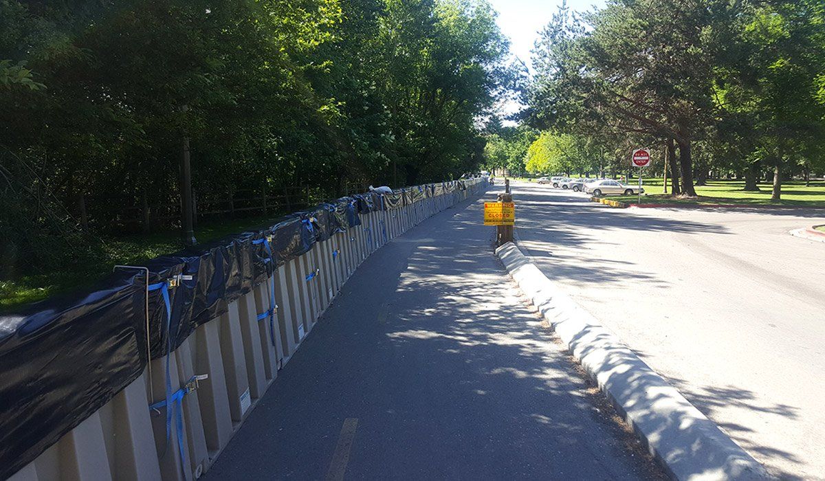
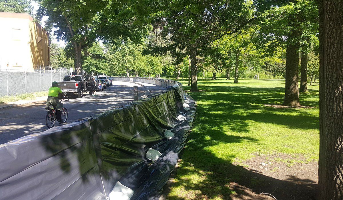
A long line of plastic barriers has appeared on the north riverbank as it snakes through the Logan River Golf Course.
It’s a product called Muscle Wall and is expected to ease flooding worries as spring runoff have created flood watch conditions.
Logan Parks and Recreation Director Russ Akina said the city purchased 600 wall segments about two weeks ago for just under $350,000. Akina said he feels confident that the Muscle Wall will prevent flooding along the golf course like Logan saw in 2011.
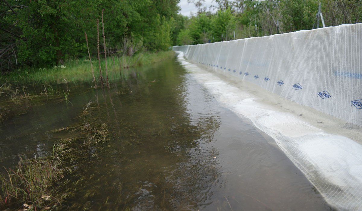
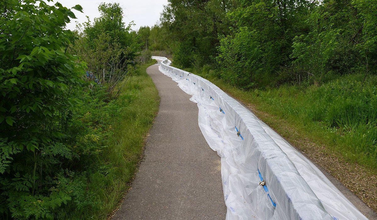
The plastic, 6-foot-long wall segments — some 2 feet tall and some 4 feet tall — are hollow. Two people can easily lift a segment and drop the interlocking pivots into place, creating a continuous barrier. Then, they are filled with water and a tarp is draped over the top to prevent erosion underneath the Muscle Wall.
Akina said city engineers have surveyed the Logan River and identified areas with low riverbanks, where water is dangerously close to overflowing. Based on reports from the National Weather Service in Salt Lake City, Akina said they are taking measures to prevent flooding.
“We’re trying to stay ahead of the anticipated runoff to protect areas, whether that is residential property or city property, including the golf course,” Akina said.
In 2011, large sections of the Logan River Golf Course were underwater. Roughly three weeks ago, Akina said, a section of the riverbank that failed in 2011 was six inches from flooding the bank. That encouraged Logan to look into options besides sandbags. He said approximately 300 sandbags would be needed for each segment of Muscle Wall, meaning somewhere in the tens of thousands would be needed along the river.
“That’s a lot of sandbags, so as an alternative to that, we decided to go with this Muscle Wall in place of that,” Akina said.
Muscle Walls are easier to install and can be reused year after year, while sandbags are heavy, labor-intensive and don’t last more than one season.
“It’s much faster and more efficient for us to be able to move sections of wall, store them and then have them back ready to use when we have to do this again,” Akina said.
Large sections of the wall were installed Saturday, and workers filled in other sections Monday. Akina said they are waiting for tarp anchors to be delivered, but as soon as they arrive the tarps will be set up and the Muscle Wall will stand ready.
Along a residential section of the river, in the Sumac area, Public Works Director Mark Nielsen said city employees will place sandbags Monday night where houses back up to the Logan River. The river is running high and fast, but cooler temperatures are expected to bring some relief.
“The river thus far has behaved very well,” Nielsen said. “It’s hot for a while, then it cools down, and that’s a great help to us to keep it where it should be.”

The waters of the Boise River are rising, but to protect animals at the Zoo Boise from potential flooding, the city is building a "muscle wall," not an Ark. The wall will be a 2-foot-high, 2,000-foot-long water-filled bladder between the zoo and river. Construction of the barrier will close Julia Davis Drive from the bandshell to the tennis courts, but the Friendship Bridge between the park and Boise State University will remain open to pedestrian and bike traffic. Evacuating Zoo Boise would cost the city of Boise $500,000-$600,000, according to city officials, while the $130,000 barrier has been touted as the most cost-effective solution to potential flooding. Another consideration, zoo officials said, would be the potential distress caused to the more than 200 animals should they need to be relocated. A wall similar to the one used to protect the zoo was deployed to hold back floodwaters at a gravel pit near Eagle Island in May. Flows on Boise River measured 9,300-9,500 cubic feet per second Tuesday and Wednesday at the Glenwood Bridge. That's the highest flow rate in the past 35 years by more than 1,000 feet per second. Meanwhile, federal water managers have warned the city flows may increase in the coming week as warm weather persists and upstream reservoirs reach capacity. High water has been a consistent challenge this spring. Boise Mayor Dave Bieter and Garden City Mayor John Evans closed most sections of the greenbelt April 14, and those sections have remained off limits to the public ever since.

On Wednesday, the City of Boise will began taking precautionary measures to protect Zoo Boise in the event that hot weather this week and fast-filling reservoirs force federal water managers to release more water into the Boise River, according to a news release. City engineers and other agency partners with the Ada County-wide team working to manage flood response Tuesday began preparations to install a 2,000-foot-long, four- to two-foot-tall “muscle wall” flood barrier. “The structure is similar to the wall constructed to protect a gravel pit near Eagle Island last month,” said City spokesman Mike Journee. “Zoo Boise managers and emergency responders are taking the proactive step because of the difficult logistics, expense and potential stress to animals if relocating the Zoo’s more than 200 animals became necessary. Additionally, federal water managers are now saying that this week’s significantly warmer weather and quickly shrinking capacity in upstream reservoirs means that notice of river flow increases could come just 24 hours in advance. That would give zoo managers little time to plan an animal evacuation, if needed,” he added. “We are doing this out of an abundance of caution to ensure we are not faced with planning a full-scale evacuation of zoo animals on short notice,” said Doug Holloway, Director of Parks and Recreation for the City of Boise. “The investment to protect the animals and zoo property is a good one, given the circumstances.” The construction of the flood barrier will force the closure of Julia Davis Drive between the bandshell and tennis courts. Friendship Bridge, the pedestrian bridge between Boise State University and Julia Davis Park, will remain open to through-traffic for pedestrians and bike traffic. However, the Greenbelt through the park and the entire city remains closed due to the high water and safety concerns. “The conditions on the Boise River and the Greenbelt become more dangerous as time goes by and the water undermines the tree roots and the foundation of the Greenbelt,” said Boise Fire Chief Dennis Doan. “These conditions are potentially fatal to the public and first responders. We ask all residents to respect this closure to prevent any tragedies.” Evacuating the more than 200 animals at Zoo Boise would cost approximately $500,000 to $600,000, plus post-flood clean-up costs and revenue lost with the zoo’s closure, officials said. “Additionally, such a move would could be extremely stressful to many of the animals. The flood barrier is expected to cost approximately $130,000 and cause animals little or no concern. Of that cost, $118,500 will be covered by grant funds from Ada County Emergency Management. Installation is expected to take one or two days and the barrier will remain in place until the zoo is no longer threatened by high water,” Journee stated. Currently, the Boise River is flowing at approximately 9,300 cubic feet per second. While federal water managers have no immediate plans of increasing those flows, they have warned city and county officials that current weather conditions likely mean advanced warning of just 24 hours if and when increases are necessary -- much shorter than the three- to four-day window of previous weeks.

Ada County is making a final effort to protect a gravel pit on Eagle Island, installing a 600-foot “muscle wall” between the Boise River and the farm field next to the pit. The wall is 2 feet tall and is directly beside the 4,000-foot temporary levee installed by the U.S. Army Corps of Engineers and the 600-foot flood diversion tube put in by Ada County last month, according to the Eagle Police Department. The tube is near the head of Eagle Island to bolster an area where swift water has eroded sections of the riverbank. So now there is a physical barrier between the river and the pit stretching all the way to the Garden City border at Duck Lake Drive. The privately owned gravel pit is near the east end of Eagle Island, not far from the Island Woods and Two Rivers neighborhoods. Officials have been worried that if that area floods, it would change the course of the river and send water in directions experts can only guess.

Ada County emergency officials are making one last preventative effort to protect the Sunroc gravel pit before Boise River flows increase next week. Crews were working along the Greenbelt Thursday morning to install this latest series of barriers. The county has put up what is called a “muscle wall” to supplement the diversion tubes that were put in place last week. It's essentially a two-foot-tall barrier filled with river water that stretches 600 feet and is designed to stop water from going over the Greenbelt, which would contribute to the possibility of a pit capture. This is all an effort to prevent a pit capture at the Sunroc gravel pit and to prevent a nearby farm field from flooding. This barrier is going up on a section of the Greenbelt that's about 1,000 feet east of the gravel pit. Ada County engineer Angie Gilman says before water is released next week this is the last effort to prepare for a pit capture where river water could be diverted in any direction. “Eventually it would head downstream but we don't know how soon it would get back into south channel, you could try and do it somewhere in vicinity of the gravel pit, but no guarantee that we can catch it there and get it back in, otherwise it would just head west into the subdivisions and Eagle Road," said Gilman. The muscle wall connects together like Lincoln Logs. “They're very light and they connect in place quite easily, so you don't need special labor or what have you, you can carry them into flood zone and then connect them as fast as you can carry them into place," said Keith Anderson, owner Flood Resolutions. And it is held in place by gravity. “We have this tow on the front side, and what the tow does is, essentially the water sits on top of this barrier and the downward pressure on this bottom tow prevents them from moving or rolling," said Anderson. About 600 feet of barrier was laid down along the Greenbelt Thursday morning. Anderson owns Flood Resolutions. Although he's be in business for 15 years, this is his company's first large-scale project here locally. “We have never done anything in Idaho, we have been here my whole life, and in my experience I have never seen flooding similar to what we are having right now," said Anderson. Now, all officials can do is wait. “This is like, let's get this done because we anticipate flows increasing, from now on it will be more watching and waiting with trees falling and chasing those sorts of things, but this is probably the last defense measure we will be taking," said Gilman. When there is no longer a concern for flooding, Anderson says the muscle wall can be drained and packed up just as quick as it was laid down and reused for the next flood season.
